Secure the right mapping license backed by expert guidance

MapsPeople Licensing: Mapbox and Google Maps – made easy

Market Access
As the only reseller of Mapbox in EMEA and one of the largest resellers of Google Maps globally, MapsPeople provides businesses with direct access to industry-leading mapping solutions. Our established partnerships enable us to offer reliable licensing, strategic pricing guidance, and streamlined onboarding.

Expert Consultation
Drawing from years of experience, our team evaluates your unique operational needs, geographic reach, budget, and industry to recommend the best platform for your use case. Whether you require global scalability, cost-efficiency, or highly customized geospatial insights, our knowledge helps you make an informed choice.

Industry Insight
From fleet management, logistics, retail, real estate, and other industries, we understand the specific challenges businesses face when integrating mapping solutions. Whether optimizing delivery networks or enhancing customer experiences, we provide the insights and support needed for your licensing process.

Process Simplification
Partnering with MapsPeople removes the complexity of licensing. We handle the details of navigating contracts, pricing structures, and compliance requirements. We help you choose the right solution, interpret usage policies, and streamline administration—so you can stay focused on running your business.
Core Solutions
By choosing MapsPeople, you gain a strategic partner who ensures that your mapping solution—whether Google Maps or Mapbox—is optimized for both performance and cost-effectiveness.
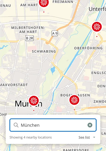
Challenge: Customers struggle to find physical locations quickly and accurately
Solution: Dynamic Maps & Geocoding provide interactive mapping tools that allow users to search for nearby stores or locations and navigate seamlessly.
Benefit: Boost visibility with easy to use maps and precise location data, improving customer engagement.
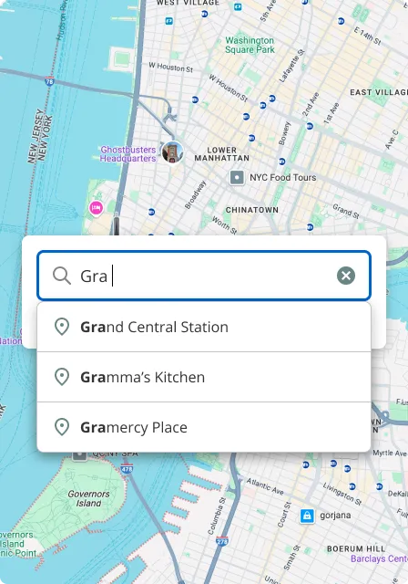
Challenge: Inefficient address entry processes lead to user frustration and routing errors.
Solution: Address Validation & Autocomplete provide real-time address suggestions and validation features that streamline the entry process and ensure accurate routing.
Benefit: Streamline data entry, reduce errors, and improve accuracy for a smoother customer experience.
Challenge: Customers struggle to find physical locations quickly and accurately.
Solution: Dynamic Maps & Geocoding provide interactive mapping tools that allow users to search for nearby stores or locations and navigate seamlessly.
Benefit: Boost visibility with easy to use maps and precise location data, improving customer engagement.
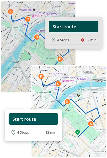
Challenge: Lack of actionable data hinders strategic decisions and resource allocation.
Solution: Place & Atmosphere Data offer detailed location analysis that highlights nearby amenities, accessibility factors, and environmental conditions relevant to your operations.
Benefit: Empower strategic planning with data-backed insights that drive smarter decisions and more efficient resource allocation.
Industry-Specific Applications
We support more than what’s shown here—wherever location matters, our mapping solutions empower your business.

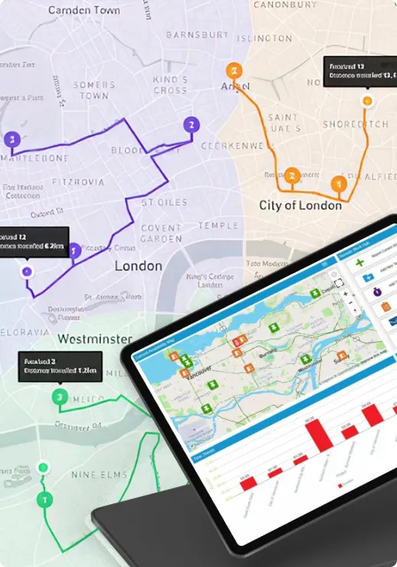
Fleet Management
Organizations use Geocoding, Dynamic Maps, Directions, and Distance Matrix APIs to enable real-time vehicle tracking, optimize delivery routes, and estimate travel times. These capabilities improve delivery efficiency, enhance route planning, and help reduce operational costs.

Retail & E-commerce
Retailers and online platforms use Dynamic Maps, Address Validation, and Autocomplete APIs to help customers locate nearby stores, validate delivery addresses, and streamline checkout. This leads to improved store visibility, smoother purchase experiences, and stronger customer engagement.

Logistics & Delivery
Companies rely on Advanced Directions, Distance Matrix, and Atmosphere Data APIs to plan delivery schedules, optimize routes, and adapt to real-time conditions. These features support efficient delivery scheduling, real-time tracking, and streamlined route planning.

Real Estate
Agents and platforms use Place Details, Geolocation, and Autocomplete APIs to visualize property locations, offer interactive maps, and deliver detailed neighborhood insights. These tools enhance property discovery and foster stronger client engagement.
Ready to optimize your mapping strategy?
Talk to Katerina